

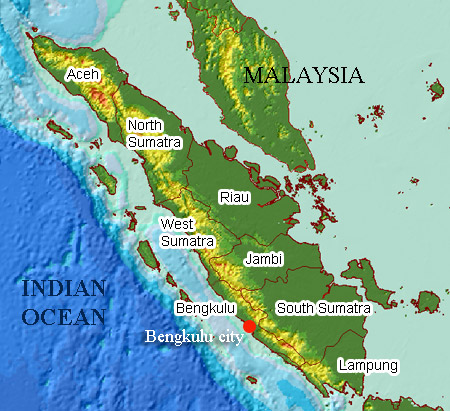
 Samosir, or Samosir Island, is a large volcanic island in Lake Toba, located in the north of the island of Sumatra in Indonesia. Administratively, Samosir Island is governed as six of the nine districts within Samosir Regency. The lake and island were formed after the eruption of a super volcano some 75,000 years ago.[1] The island was originally connected to the surrounding caldera wall by a small isthmus, which was cut through to aid
 navigation.
At 630 km², Samosir is the largest island within an island, and the fifth largest lake island in the world.[2] It also contains two smaller lakes, Lake Sidihoni and Lake Aek Natonang. Across the lake on the east from the island lies Uluan Peninsula. The island is linked to the mainland of Sumatra on its western part by a narrow land connecting the town of Pangururan on Samosir and Tele on mainland Sumatra. Tele consequently offers one of the best views of Lake Toba and Samosir Island.
 |
| Samosir Island |
Samosir is a popular tourist destination due to its exotic history and the vistas it offers. The tourist resorts are concentrated in the Tuktuk area. The island is the centre of the Batak culture and many of this people's artifacts remain on the island. Most of the tourist accommodations are concentrated in the small town of Tuktuk, which is located a one-hour ferry ride across the lake from the town of Parapat. The island measures 45 by 20 km, and originally was a peninsula. It only became a peninsula after the Dutch arrived and dug a canal across the small piece of land of 200 metres in 1906. This action seemed to have a lot to do among the local population, because they thought the island would slip away towards the middle of the lake and simply dissappear.
 |
The eastern coast of the island rises steeply from a small bank towards a central plateau with an altitude of 780 metres. This gradually descends towards the southern and western coast of the island and is scattered with small villages which dangerously lean against the rock, and cross ravains. The Samosir plateau mainly is clear rock, with some scattered forests, swamps and a small lake. There is a road parallel with the shores of the island, but this can be bad at certain points, with a number of bad bridges in the southwestern corner. From Pangururan, the kecamatan-centre at the western side, a bridge connects the island with mainland Sumatera. The road ascends to an altitude of 1800 metres after that. Here, the village of Tele offers a good view over the lake and the island. During the northeastern monsoon (September until January), a strong wind usually arrived from the high altitudes, the alogo bolong or 'big wind'. This produces waves of over one metre high, which can made traffic over water very hard. Local ferries, most of the time overloaded with freight and people, can be lost during these storms. Earlier the Batak used big tree-trunk canoos (solu) made of a single tree to cross the lake. Noaways only very small canoos are used. F.M. Schnitget, author of 'Forgotten Kingdoms in Sumatera', visited Samosir in the 1930's and described the adathouses, stone graves and coffins of no less than 26 villages. Looking for these villages is hard, because many of the names have been changed since them; others were abandoned and some of the stone sarcofagusses were removed from their original location. Outside the paved roads time and patience are an important factor to find the graves. But for many people a visit to Samosir is no more than a quiet ferry fare to Tomok, where the most famous of all Toba Bakat sarcofasussus are just on a few minutes away from the pier.
Horas is the local greeting delivered with enthusiasm. The Batak people love their lake and island, and many traditional local songs are written about it. You are sure to hear some of these Batak songs on visit to Samosir island Lake Toba, singing is a strong part of the local culture walk past (or into) a toddy shop any evening after local men have consumed a few glasses of Tuak, or palm wine , and hear it for your self.
Lissoi is their saying for cheers. There are also some fine woodcarvers on Samosir Island, as a glance at any of the souvenir shops will verify.
Horas is the local greeting delivered with enthusiasm. The Batak people love their lake and island, and many traditional local songs are written about it. You are sure to hear some of these Batak songs on visit to Samosir island Lake Toba, singing is a strong part of the local culture walk past (or into) a toddy shop any evening after local men have consumed a few glasses of Tuak, or palm wine , and hear it for your self.
 |
| Samosir Island Agriculture |
Lissoi is their saying for cheers. There are also some fine woodcarvers on Samosir Island, as a glance at any of the souvenir shops will verify.
Samosir District has tourism potential areas based on natural scenery, spiritual tourism, agricultural tourism, cultural tourism and the waters of Lake Toba. Recreational areas are scattered in various sub regions are:
Simanindo Sub-District
1. Historical Tours

Parsidangan stone, located in the village Siallagan is arranged in such a stone in the reign of King Siallagan to prosecute and execute the criminals.
Museum Huta Bolon, where the ancient artifacts of the Batak
2. Tourism Arts and Culture
Performing Sigale-gale, was in Tomok is folk art sculptures are made in such form that can be danced to traditional music gondang
Art Building, the building of cultural and artistic attractions, located in Tuktuk Siadong
Marhosa stone, was in sigarantung, village Parmonangan benafas stone is a natural phenomenon or can exhale air
- Marlakkop Goa, in the village of Tanjung
- Stone fences and Bottean, in Lontung
- Ambarita beach, where bathing and fishing
- Aek Natonang tanjungan village located in a lake on the lake and is planned as an area covering 105 ha Forest Tourism.
- Pulo Tao, a restaurant and camping ground located in the Coastal Village Simanindo.
- Tuktuk Siadong, shaped area promontory peninsula is strategically so that now a center of tourist activities (central tourism district), met by the hotel and restaurant businesses as well as painter and engraver.
- Beta International Kite hill, a special area in Tuktuk Siadong to the location of the International kite game.
2. Pangururan Sub-District
 |
| Hot Water Baths |
 |
| Liberty Malau Statue |
Object History Tours
Tano Ponggol Canal, the canal that separates the island of Sumatra Island Samosir made by the Dutch Colonial and still functioning.
Persanggarahan, Dutch colonial heritage buildings which are currently used as office and residence of Acting Regent Naidoo, located in the City Pangururan.
Statue of Liberty Malau, A memorial of a warrior armed struggle 45 of Samosir Island helped the Republic of Indonesia's independence.
Tourism Arts and Culture
Open Stage, building an open stage in the middle of the City Pangururan as art and cultural attractions.
Weaving Ulos Batak community, community groups who work on traditional looms in the village of Batak ulos Lumban Suhi-suhi within + 4 km from the City Pangururan.
Sianjur Mula-Mula Sub-District
 |
| Water Seven Flavors |
 |
| Pusuk Buhit Mountain |
 Object Nature Tourism
Mount Pusuk Buhit, Batak ethnic origin
Aek Boras, Teacher springs Tatea Month
Sipitu Dai Aek, water sources can be streamed into seven channels and has seven flavors and can be believed to cure various diseases.
Sawan Stone, Stone of the lime-flavored water
Tulas Pulo, a small island in the middle of Lake Toba

Object History Tours
Parhusipan Stone, a meeting place Si Boru Pareme
Stone Pargasipan,
Nanggor stone, place stone hammer Bukit Raja Thousand forge weapons
Hobon stone, stone storage of heirlooms.
Sigulatti, Places in the mountains Pusuk Buhit believed the origin of the Batak people.
Harian Bobo Sub-District

Partukko Naginjang, in the Village of Promise Martahan Martahan, landing sites peterbang kiteWaterfall Sampuran Ephrath Dolok bill, with a height of 26 M and 10 M width is 3 KM from the Daily Boho
Pohan Pokki Springs, in Sihotang within 2 KM from the Port Sihotang.
Onan Runggu Sub-District
 Lagundi Sitamiang, the location for the camp is equipped with a cabin teen
Surlau Tambun, natural baths with water fresh and cool air
Hariara Na Bolon, a natural phenomenon in which the miraculous banyan tree (hariara) fused to form a very large tree
Sukkean Free beach, beaches with pristine white sand and has been frequently visited by foreign tourists for bathing and sunbathing.
Nainggolan Sub-District

Stone Master, A has three foundation stones are believed to be the slogan of the Batak people of "dalihan Natolu"
Maria Raja beach, free beach in the village of Maria Raja with white sand and crystal clear lake water for bathing and recreation.
Sitio-Tio Sub-District

Datu Parngongo Springs, + 4 km from Pier Tamba is a magical fountain made by a Datu Parngongo contained in a very steep hillside.
The beach is free, location in the village Sabulan
Boru Saruding baths, located in Ranssangbosi around + 35 km from Pangururan.
Ronggur ni Huta Sub-District
 Sidihoni Lake, a lake in the middle of the island of Samosir be unique as the lake above the lake.
Aek Liang, a natural phenomenon of spring in the cave.
Cave Sidam-dam
Sidam-stone dam, which is still the sacred black stone and sacral
Palipi Sub-District

Stone Chain, in the City Mogang
Somalim Piso, a historic place in Mogang
Hot Water Simbolon, rocky areas where there is a sulfur hot springs are still natural.
(Source http://samosirtourism.com/com,http://samosirkab.go.id)